Outdoors
Games
Hobbies
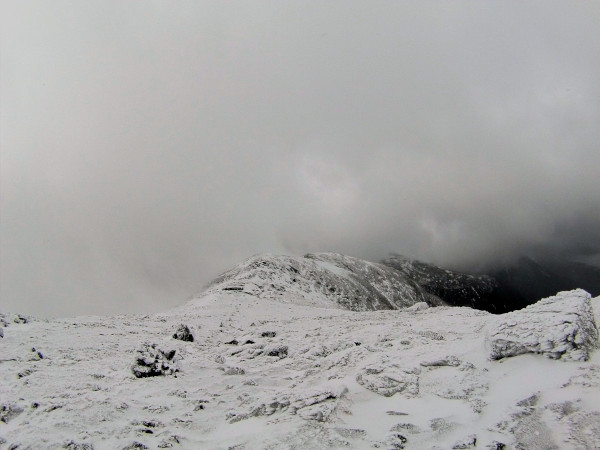
March/April 2019 2-Day Presidential TraversePlanning a 2-day Presidential Traverse in the White Mountains. Start from the north end, camp at Sphinx Col, and end at Crawford Notch. Pre- and post- nights will be either in camper at trailhead or nearby hotel. Report from Joe's solo Presidential Traverse last year Contact Joe with questions. Gulfside Trail heading north from the Great Gulf north of Mt Washington OverviewSeven Presidentials, the minimum route
Common bonus summits, not actually named after presidents
North to south is typical
Main stretch is all above tree line for ~12 miles
DatesCandidates:
A Thursday start (Mar 21, Mar 28, or Apr 11) with flexibility to slip a day for better weather is ideal. CostPersonal equipment rental(s) if needed (~$125) Shared hotel room or personal hostel cost (2x ~$30 person) Shared tent rental(s) (3x ~$30 /person) Shared gas + tolls Personal food FitnessNeed to be able to hike for 6--8+ hours at steady pace with a winter pack. Some trails are steep, some rugged, but there's nothing approaching vertical climbing (like, say, the early bottleneck on the Lion's Head winter route to Mt Washington). Setting up and tearing down camp on Sphinx Col could be brutal cold & windy. WeatherGeneral Randolph, NH (north trailhead) weather General Bretton Woods (south trailhead) weather RMC Conditions at Gray Knob Cabin Mt Washington Observatory reports Mt Washington Avalanche Center Advisory Be prepared for snow, serious wind, and extreme cold, especially overnight at Sphinx Col.
ItineraryFour day, three night trip--- Day 1: Travel
Day 2: Northern Half (Madison, Adams, Jefferson)
Day 3: Southern Half (Washington, Monroe, Eisenhower, Pierce)
Day 4: Return
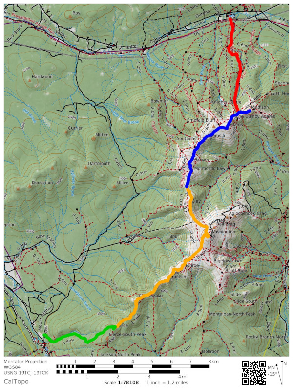
CalTopo map of routes Gear
Mountaineering boots, crampons, axe required
Micro-spikes and trekking poles recommended Snowshoes might be useful emergency gear (though hopefully unnecessary extra weight) LodgingTwo nights in hotel or hostel if not using Gunnar's camper
One night in tent(s) at Sphinx Col
|
| Recent Changes (All) | Edit SideBar | Page last modified on January 17, 2019, at 11:18 AM | Edit Page | Page History |

